ABOUT BROOMFIELD, CO
Broomfield sits between Denver and Boulder along US 36, and it holds a distinction no other Front Range community can claim: it is both a city and a county. Farms dotted the area in the late 1800s, and when a post office opened here in 1884 it was named Broomfield, most likely for the broomcorn local farmers grew and sold to broom makers. The rail stop near today's 120th Avenue and Old Wadsworth Boulevard was known as Zang's Spur, after the spur line that carried local grain to the Zang family's brewery in Denver.
Broomfield incorporated as a city in 1961 and grew across parts of four counties: Boulder, Adams, Jefferson and Weld. Working with four county governments became complicated, so in 1998 Colorado voters approved a constitutional amendment allowing Broomfield to form its own county. On November 15, 2001, the City and County of Broomfield became Colorado's 64th county, the newest county in the state and the smallest by area. Some of that early history is still standing. The Broomfield Depot Museum, a 1909 railroad depot moved to Zang Spur Park in 1976, sits beside the Crawford Honey House, and the restored 1908 Brunner Farmhouse on Main Street serves as a community gathering place with gardens and a trailhead into The Field open space.
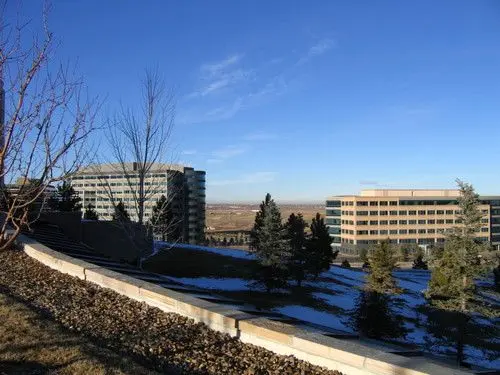
Today Broomfield combines established neighborhoods near Original Broomfield with newer communities such as Anthem on the city's north side. Along US 36, the Interlocken business park and FlatIron Crossing shopping center bring together offices, dining and retail, with mountain views to the west. Open space is woven throughout the city, from Broomfield County Commons and Josh's Pond to Metzger Farm Open Space and the Carolyn Holmberg Preserve at Rock Creek Farms, and the Rock Creek and Coal Creek trails connect many of them. The US 36 Bikeway runs alongside the highway toward Boulder, and RTD's Flatiron Flyer bus rapid transit stops at the US 36 and Broomfield and US 36 and Flatiron stations, with direct service to Denver Union Station and downtown Boulder. With US 36, I-25 and the Northwest Parkway nearby, Broomfield offers quick access to Denver, Boulder and the northern Front Range.
CO
Broomfield
listing detail
LISTINGS
- 1/5 5
 New
$650,000
3 Beds2 Baths1,783 SqFt14311 Old Cottonwood ST, Broomfield, CO 80020
Single Family Home
MLS# 9025340
Listed byKeller Williams DTC

- 3D
 New
$385,000
2 Beds2 Baths1,129 SqFt13900 Lake Song LN #B3, Broomfield, CO 80023
Townhouse
MLS# 3051603
Listed byRE/MAX Northwest Inc
- 1/48 48
 New
$559,000
5 Beds4 Baths2,416 SqFt17646 Olive ST, Broomfield, CO 80023
Single Family Home
MLS# 9880753
Listed byColdwell Banker Global Luxury Denver
- 1/44 44
 New
$2,300,000
5 Beds5 Baths4,703 SqFt14640 Clay ST, Broomfield, CO 80023
Single Family Home
MLS# 5083574
Listed byEdelweiss Realty
- 1/24 24
 New
$510,000
5 Beds3 Baths2,146 SqFt820 Lotus WAY, Broomfield, CO 80020
Single Family Home
MLS# IR1072406
Listed byCompass - Boulder
- 1/50 50
 New
$1,200,000
6 Beds4 Baths5,276 SqFt600 Redstone DR, Broomfield, CO 80020
Single Family Home
MLS# 2016914
Listed byColdwell Banker Realty 56
RECENTLY SOLD LISTINGS
Image
Address
Sold Date
Property Type
Configuration
Price

12640 Xavier ST, Broomfield, CO 80020
Single Family Home
4 Beds4 Baths2,061 SqFt
$ 695,000
MLS# IR1070708
Listed byWK Real Estate


15200 Zuni ST, Broomfield, CO 80023
Single Family Home
4 Beds3 Baths3,184 SqFt
$ 1,000,000
MLS# 5412793
Listed by8z Real Estate

3630 Vestal LOOP, Broomfield, CO 80023
Single Family Home
5 Beds5 Baths4,649 SqFt
$ 985,000
MLS# 3308028
Listed byRE/MAX Professionals
Coming Soon
Commute Score
Coming Soon
Coming Soon
demographics
Population
Density
Households
Gender
Coming Soon
Education
Coming Soon
Coming Soon
Coming Soon
Coming Soon
FAQs
To help you make informed decisions, we've compiled answers to some of the most commonly asked questions.
Is Broomfield a city or a county?
Both. Broomfield is a consolidated city and county. It incorporated as a city in 1961, and on November 15, 2001, the City and County of Broomfield became Colorado's 64th county. Before that, the city spanned parts of Boulder, Adams, Jefferson and Weld counties.
Where is Broomfield, Colorado?
How did Broomfield get its name?
Can you get from Broomfield to Denver or Boulder without a car?
What school districts serve Broomfield?

Joshua Jones
josh@yourdenverrealtor.com